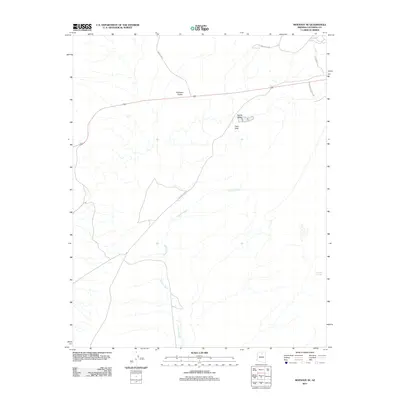
2011 Map of Moenave SE
USGS Topo · Published 2011About this map
Dinosaur Tracks serve as a primary landmark in this high-desert landscape, positioned alongside the modern roadway and north of the striking Tuba Arch. The terrain is defined by a network of ephemeral drainages, most notably Fivemile Wash, which winds across the southern and central portions of the quadrangle. High-altitude points such as Toh Nee Di Kishi overlook the broad Kerley Valley, while vital water sources like Billy Spring provide rare geographic markers in an otherwise arid region. The map reflects a modern Navajo Nation infrastructure, showing the intersection of routes like Indian Rte 23 and Indian Rte 101 as they navigate the ridges and washes of Coconino County.
Find a feature on this map
10 named features on this map. Tap any name to fly to it.
Don’t see what you’re looking for? This feature index may not catch every label — zoom into the map to look around manually.
Map Details
Editions of this 2011 Moenave SE Map
This is the sole edition of this map. No revisions or reprints were ever made.
Other maps of this area

1886 · San Francisco Mtns
USGS Topo · 1:250,000

1886 · Echo Cliffs
USGS Topo · 1:250,000

1891 · San Francisco Mtns
USGS Topo · 1:250,000

1891 · Echo Cliffs
USGS Topo · 1:250,000

1894 · San Francisco Mtns
USGS Topo · 1:250,000

1899 · San Francisco Mtns
USGS Topo · 1:250,000

1947 · Flagstaff
USGS Topo · 1:250,000

1954 · Flagstaff
USGS Topo · 1:250,000

1955 · Moa Ave NW
USGS Topo · 1:24,000
1955 · Moa Ave SW
USGS Topo · 1:24,000