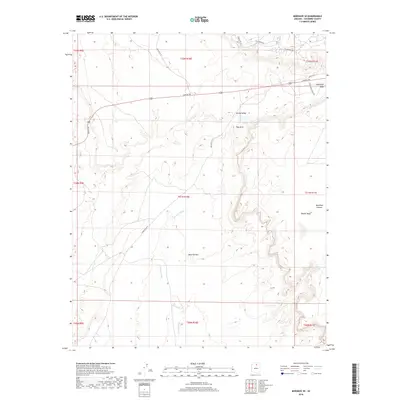
2018 Map of Moenave SE
USGS Topo · Published 2018About this map
Tuba Arch and the sweeping formations of Ward Terrace define this high-desert landscape in northern Arizona as it appeared in the late 2010s. The terrain is marked by seasonal watercourses like Fivemile Wash and Moenkopi Wash, which have carved intricate drainages through the Kerley Valley. Higher elevations are represented by the Moenkopi Plateau and Tohnali Mesa, providing a clear look at the geological benchlands that characterize this region.
Find a feature on this map
26 named features on this map. Tap any name to fly to it.
Don’t see what you’re looking for? This feature index may not catch every label — zoom into the map to look around manually.
Map Details
Editions of this 2018 Moenave SE Map
This is the sole edition of this map. No revisions or reprints were ever made.
Other maps of this area

1886 · San Francisco Mtns
USGS Topo · 1:250,000

1886 · Echo Cliffs
USGS Topo · 1:250,000

1891 · San Francisco Mtns
USGS Topo · 1:250,000

1891 · Echo Cliffs
USGS Topo · 1:250,000

1894 · San Francisco Mtns
USGS Topo · 1:250,000

1899 · San Francisco Mtns
USGS Topo · 1:250,000

1947 · Flagstaff
USGS Topo · 1:250,000

1954 · Flagstaff
USGS Topo · 1:250,000

1955 · Moa Ave NW
USGS Topo · 1:24,000
1955 · Moa Ave SW
USGS Topo · 1:24,000