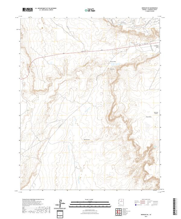
2021 Map of Moenave SE
USGS Topo · Published 2021About this map
Kerley Valley and the surrounding high desert terrain define this portion of the Navajo Nation as it appeared in recent years. The landscape is characterized by prominent geological formations and drainage systems, including the Moenkopi Plateau and the eroded Ward Terrace. Modern transportation corridors like the Navajo Trl (U.S. Route 160) and Indian Rte 101 cross the arid flats, connecting the region to nearby population centers while following historical paths through the wash-carved terrain. The presence of Billy Spring and seasonal watercourses such as Moenkopi Wash and Fivermile Wash highlights the critical role of water sources in this environment. Notable landmarks such as Tuba Arch and Tohnali Mesa provide essential orientation points across the expansive plateau, where traditional land divisions still follow the township and range system.
Find a feature on this map
26 named features on this map. Tap any name to fly to it.
Don’t see what you’re looking for? This feature index may not catch every label — zoom into the map to look around manually.
Map Details
Editions of this 2021 Moenave SE Map
This is the sole edition of this map. No revisions or reprints were ever made.
Other maps of this area

1886 · San Francisco Mtns
USGS Topo · 1:250,000

1886 · Echo Cliffs
USGS Topo · 1:250,000

1891 · San Francisco Mtns
USGS Topo · 1:250,000

1891 · Echo Cliffs
USGS Topo · 1:250,000

1894 · San Francisco Mtns
USGS Topo · 1:250,000

1899 · San Francisco Mtns
USGS Topo · 1:250,000

1947 · Flagstaff
USGS Topo · 1:250,000

1954 · Flagstaff
USGS Topo · 1:250,000

1955 · Moa Ave NW
USGS Topo · 1:24,000
1955 · Moa Ave SW
USGS Topo · 1:24,000