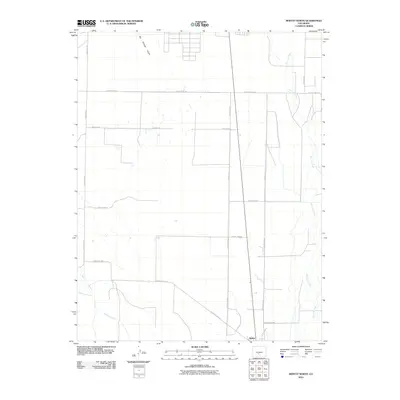
2010 Map of Moffat North
USGS Topo · Published 2010About this map
Moffat sits at the southern edge of this San Luis Valley survey, serving as a hub for a geometric grid of rural routes that define the region's agricultural landscape. The terrain is marked by the winding courses of San Luis Creek to the east and the convergence of Saguache Creek and the North Branch Saguache Creek in the southwest. These watercourses illustrate the irrigation-dependent nature of the high-desert valley, where water rights and drainage patterns dictate land use. To the north, Big Hollow Gulch cuts through the open flats, providing a natural break in the otherwise orderly arrangement of throughways like County Road AA and County Rd 59. The map captures a moment of modern rural continuity, where traditional water-boundary geography meets the rigid precision of 21st-century county planning.
Find a feature on this map
16 named features on this map. Tap any name to fly to it.
Don’t see what you’re looking for? This feature index may not catch every label — zoom into the map to look around manually.
Map Details
Editions of this 2010 Moffat North Map
This is the sole edition of this map. No revisions or reprints were ever made.
Other maps of this area

1915 · Del Norte
USGS Topo · 1:125,000

1917 · Del Norte
USGS Topo · 1:125,000

1945 · Durango
USGS Topo · 1:250,000

1950 · Valley View Hot Springs
USGS Topo · 1:24,000

1953 · Durango
USGS Topo · 1:250,000

1954 · Durango
USGS Topo · 1:250,000

1954 · Trinidad
USGS Topo · 1:250,000

1954 · Pueblo
USGS Topo · 1:250,000

1955 · Trinidad
USGS Topo · 1:250,000

1956 · Montrose
USGS Topo · 1:250,000