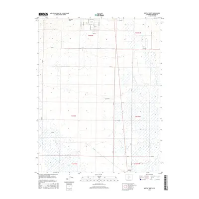
2016 Map of Moffat North
USGS Topo · Published 2016About this map
The northern reaches of Moffat anchor this portion of the San Luis Valley, where the settlement grid transitions into a vast expanse of wetland and drainage networks. The landscape is defined by the convergence of San Luis Cr and Saguache Cr, creating a complex system of seasonal watercourses. To the north, the terrain gains slight elevation near Big Hollow Gulch, a prominent drainage feature that breaks the otherwise flat valley floor. The map documents a distinct residential development pattern near the town center, characterized by family-named streets such as Nakashima Ave, Eva K Dr, and Tappero Ave. This layout reflects a more modern suburban-style platting compared to the surrounding rural sections, which are defined by long county roads like Kit Carson Rd and Co RD Aa that follow the Public Land Survey System boundaries.
Find a feature on this map
37 named features on this map. Tap any name to fly to it.
Don’t see what you’re looking for? This feature index may not catch every label — zoom into the map to look around manually.
Map Details
Editions of this 2016 Moffat North Map
This is the sole edition of this map. No revisions or reprints were ever made.
Other maps of this area

1915 · Del Norte
USGS Topo · 1:125,000

1917 · Del Norte
USGS Topo · 1:125,000

1945 · Durango
USGS Topo · 1:250,000

1950 · Valley View Hot Springs
USGS Topo · 1:24,000

1953 · Durango
USGS Topo · 1:250,000

1954 · Durango
USGS Topo · 1:250,000

1954 · Trinidad
USGS Topo · 1:250,000

1954 · Pueblo
USGS Topo · 1:250,000

1955 · Trinidad
USGS Topo · 1:250,000

1956 · Montrose
USGS Topo · 1:250,000