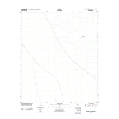
2011 Map of Mohawk Mountains SW
USGS Topo · Published 2011About this map
Mohawk Mountains dominate the eastern reaches of this Yuma County landscape, defined by an arid basin-and-range topography. The desert floor is marked by the branching drainage of Mohawk Wash, which courses through the southern and central sections of the sheet. Evidence of transit through this isolated corridor is found along the Mohawk Papago Well Rd, a route cutting diagonally across the quadrangle. A unique hydrologic feature, Glynns Falls, is noted among the mountain slopes, suggesting a seasonal or intermittent water source in an otherwise dry environment. The sparse labeling reflects the remote character of this desert region, where life and travel are dictated by the presence of washes and established well roads.
Find a feature on this map
4 named features on this map. Tap any name to fly to it.
Don’t see what you’re looking for? This feature index may not catch every label — zoom into the map to look around manually.
Map Details
Editions of this 2011 Mohawk Mountains SW Map
This is the sole edition of this map. No revisions or reprints were ever made.
Other maps of this area

1926 · Mohawk
USGS Topo · 1:62,500

1927 · Kim
USGS Topo · 1:62,500

1928 · Mohawk
USGS Topo · 1:62,500

1931 · Kim
USGS Topo · 1:62,500

1953 · Ajo
USGS Topo · 1:250,000

1957 · Ajo
USGS Topo · 1:250,000

1958 · Ajo
USGS Topo · 1:250,000

1962 · Ajo
USGS Topo · 1:250,000

1963 · Ajo
USGS Topo · 1:250,000

1965 · Cabeza Prieta Peak
USGS Topo · 1:62,500