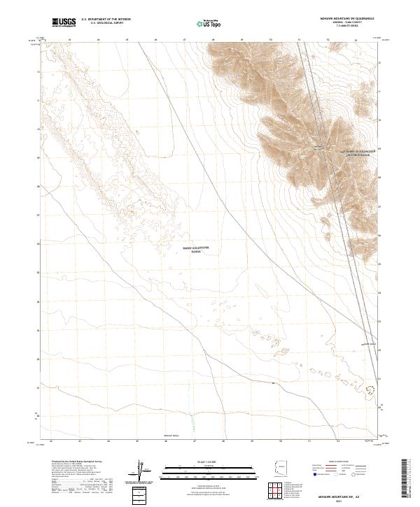
2021 Map of Mohawk Mountains SW
USGS Topo · Published 2021About this map
The Mohawk Mountains rise sharply above the desert floor in this arid expanse of Yuma County. This landscape is defined by the stark contrast between the steep ridgelines of the mountain range and the wide, open plains of the Mohawk Valley. Water is a transient but powerful sculptor here, evidenced by the extensive drainage network of Mohawk Wash, which carries seasonal runoff from the higher elevations across the valley floor. The map highlights the vastness of the public land survey system, showing the township and range divisions that structure this remote region. For those studying the geography of the Southwestern desert, this survey provides a precise look at how the terrain transitions from rugged peaks to alluvial fans in an area largely untouched by modern development.
Find a feature on this map
9 named features on this map. Tap any name to fly to it.
Don’t see what you’re looking for? This feature index may not catch every label — zoom into the map to look around manually.
Map Details
Editions of this 2021 Mohawk Mountains SW Map
This is the sole edition of this map. No revisions or reprints were ever made.
Other maps of this area

1926 · Mohawk
USGS Topo · 1:62,500

1927 · Kim
USGS Topo · 1:62,500

1928 · Mohawk
USGS Topo · 1:62,500

1931 · Kim
USGS Topo · 1:62,500

1953 · Ajo
USGS Topo · 1:250,000

1957 · Ajo
USGS Topo · 1:250,000

1958 · Ajo
USGS Topo · 1:250,000

1962 · Ajo
USGS Topo · 1:250,000

1963 · Ajo
USGS Topo · 1:250,000

1965 · Cabeza Prieta Peak
USGS Topo · 1:62,500