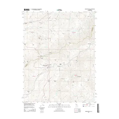
2015 Map of Mokelumne Hill
USGS Topo · Published 2015About this map
Mokelumne Hill serves as the central hub of this Mother Lode landscape, where the rugged terrain of the Sierra Nevada foothills is defined by a complex network of gold-country gulches and water engineering. The map reveals an intricate system of water transport, including the Amador Canal, Upper Standard Canal, and the Electra Tunnel, which support the hydroelectric legacy of Electra along the Mokelumne River. Significant elevation changes are marked by numerous named ravines such as Hundred Ounce Gulch and Chili Gulch, names that echo the region's mining heritage. Small settlements like Jesus Maria and Happy Valley are connected by winding routes like Milligan School Rd and Clinton Rd, while landmarks like Jackson Butte and French Hill overlook a landscape deeply carved by the N Fork Calaveras River and its many tributaries.
Find a feature on this map
95 named features on this map. Tap any name to fly to it.
Don’t see what you’re looking for? This feature index may not catch every label — zoom into the map to look around manually.
Map Details
Editions of this 2015 Mokelumne Hill Map
This is the sole edition of this map. No revisions or reprints were ever made.
Other maps of this area

1889 · Jackson
USGS Topo · 1:125,000

1892 · Jackson
USGS Topo · 1:125,000

1897 · Jackson
USGS Topo · 1:125,000

1902 · Jackson
USGS Topo · 1:125,000

1941 · Sutter Creek
USGS Topo · 1:62,500

1944 · Valley Springs
USGS Topo · 1:62,500

1944 · Sutter Creek
USGS Topo · 1:62,500

1945 · San Andreas
USGS Topo · 1:62,500

1947 · San Andreas
USGS Topo · 1:62,500

1947 · Sacramento
USGS Topo · 1:250,000