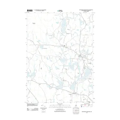
2012 Map of Monadnock Mountain
USGS Topo · Published 2012About this map
Monadnock Mountain towers over the landscape of southern New Hampshire, anchoring a region defined by its glacial lakes and early industrial settlements. In the shadow of the peak, the town of Jaffrey and the village of Jaffrey Center retain their historic character, evidenced by the Old Center Cem and the former industrial hub at Jaffrey Mills along the Contoocook River. The presence of Franklin Pierce University near Pearly Lake indicates the area's modern educational role, while several summer retreats like Camp Wa-Klo and Camp Wanoskett reflect a long tradition of seasonal recreation around Thorndike Pond and Gilson Pond. Further south, the community of West Rindge sits near the shores of Pool Pond, marking the transition into the town of Rindge. This 2012 survey illustrates a landscape where colonial-era burying grounds and family-named hills like Peabody Hill and Fullam Hill coexist with modern aviation at the Jaffrey Airport-Silver Ranch.
Find a feature on this map
157 named features on this map. Tap any name to fly to it.
Don’t see what you’re looking for? This feature index may not catch every label — zoom into the map to look around manually.
Map Details
Editions of this 2012 Monadnock Mountain Map
This is the sole edition of this map. No revisions or reprints were ever made.
Other maps of this area

1887 · Winchendon
USGS Topo · 1:62,500

1887 · Fitchburg
USGS Topo · 1:62,500

1889 · Fitchburg
USGS Topo · 1:62,500

1890 · Winchendon
USGS Topo · 1:62,500

1893 · Fitchburg
USGS Topo · 1:62,500

1894 · Winchendon
USGS Topo · 1:62,500

1898 · Monadnock
USGS Topo · 1:62,500

1900 · Peterboro
USGS Topo · 1:62,500

1931 · Fitchburg
USGS Topo · 1:48,000

1932 · Winchendon
USGS Topo · 1:48,000