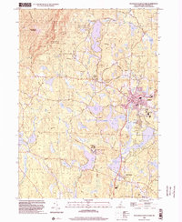
1998 Map of Monadnock Mountain
USGS Topo · Published 2002About this map
Monadnock State Park anchors the northwestern corner of this Cheshire County landscape, defined by its complex network of footpaths including the White Dot Trail and Pumpelly Trail. The late twentieth-century development patterns of Jaffrey and Rindge are visible, with residential expansion and recreational facilities like a Golf Course and the Jaffrey Muni Silver Ranch Airport situated alongside older village centers.
Find a feature on this map
67 named features on this map. Tap any name to fly to it.
Don’t see what you’re looking for? This feature index may not catch every label — zoom into the map to look around manually.
Map Details
Editions of this 1998 Monadnock Mountain Map
This is the sole edition of this map. No revisions or reprints were ever made.
Other maps of this area

1887 · Winchendon
USGS Topo · 1:62,500

1887 · Fitchburg
USGS Topo · 1:62,500

1889 · Fitchburg
USGS Topo · 1:62,500

1890 · Winchendon
USGS Topo · 1:62,500

1893 · Fitchburg
USGS Topo · 1:62,500

1894 · Winchendon
USGS Topo · 1:62,500

1898 · Monadnock
USGS Topo · 1:62,500

1900 · Peterboro
USGS Topo · 1:62,500

1931 · Fitchburg
USGS Topo · 1:48,000

1932 · Winchendon
USGS Topo · 1:48,000