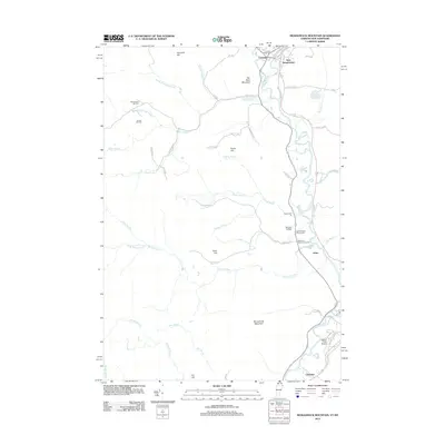
2012 Map of Monadnock Mountain
USGS Topo · Published 2012About this map
Canaan and West Stewartstown anchor the northern reaches of this New Hampshire and Vermont border region, where the landscape is defined by the prominent peak of Monadnock Mountain. The area is densely mapped with small, family-oriented burial grounds that speak to the long history of local settlement, including Old Canaan Hill Cem and the South Canaan Church Cem. Moving south from the populated centers along the river, the terrain transitions into the high grounds of Van Dyke Mountain and Harriman Hill, drained by a complex network of waterways such as Jacobs Chopping Brook and Schoolhouse Brook. Aviation history is well-represented on the eastern side of the valley by both Bunnell Airfield and Gifford Field Airport. This 2012 survey captures the modern road network, including Old US 3 and Fire Tower Ln, layered over a rural landscape where small communities like Arlins and Columbia maintain their distinct identities along the winding river corridor.
Find a feature on this map
61 named features on this map. Tap any name to fly to it.
Don’t see what you’re looking for? This feature index may not catch every label — zoom into the map to look around manually.
Map Details
Editions of this 2012 Monadnock Mountain Map
This is the sole edition of this map. No revisions or reprints were ever made.
Other maps of this area

1925 · Indian Stream
USGS Topo · 1:48,000

1926 · Indian Stream
USGS Topo · 1:62,500

1927 · Indian Stream
USGS Topo · 1:62,500

1929 · Averill
USGS Topo · 1:62,500

1930 · Dixville
USGS Topo · 1:62,500

1933 · Dixville
USGS Topo · 1:62,500

1934 · Dixville
USGS Topo · 1:62,500

1949 · Jackman
USGS Topo · 1:250,000

1950 · Lewiston
USGS Topo · 1:250,000

1953 · Averill
USGS Topo · 1:62,500