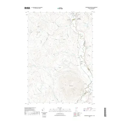
2018 Map of Monadnock Mountain
USGS Topo · Published 2018About this map
West Stewartstown sits along the bend of the Connecticut River, serving as a focal point for this borderland where New Hampshire meets Vermont. The landscape is defined by significant elevations like Monadnock Mtn and Van Dyke Mtn, with a network of drainage systems including Willard Stream and Jacobs Chopping Brook carving through the terrain. For genealogists, the map is particularly detailed regarding burial sites, noting several distinct locations such as the South Canaan Church Cem, Old Canaan Hill Cem, and the Morrison Schoolhouse Cem. These sites, along with the naming of Schoolhouse Brook and Canaan Hill Rd, suggest the locations of early rural centers and family homesteads. Near the river, Gifford Field and Airport Rd represent modern transportation infrastructure amidst a largely wooded and stream-cut environment.
Find a feature on this map
65 named features on this map. Tap any name to fly to it.
Don’t see what you’re looking for? This feature index may not catch every label — zoom into the map to look around manually.
Map Details
Editions of this 2018 Monadnock Mountain Map
This is the sole edition of this map. No revisions or reprints were ever made.
Other maps of this area

1925 · Indian Stream
USGS Topo · 1:48,000

1926 · Indian Stream
USGS Topo · 1:62,500

1927 · Indian Stream
USGS Topo · 1:62,500

1929 · Averill
USGS Topo · 1:62,500

1930 · Dixville
USGS Topo · 1:62,500

1933 · Dixville
USGS Topo · 1:62,500

1934 · Dixville
USGS Topo · 1:62,500

1949 · Jackman
USGS Topo · 1:250,000

1950 · Lewiston
USGS Topo · 1:250,000

1953 · Averill
USGS Topo · 1:62,500