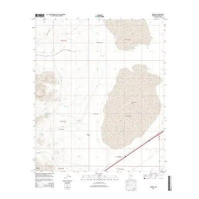
2013 Map of Mondel
USGS Topo · Published 2013About this map
The settlement of Mondel sits at a critical junction of infrastructure and desert hydrology in this portion of Hidalgo County. The landscape is defined by the expansive South Alkali Flat, a massive basin that collects drainage from numerous seasonal watercourses including Rustler Draw, Sixtysix Draw, and Volcano Draw. This arid environment necessitated an extensive network of water management features, evidenced by various tanks such as Butterfield Tank, Lake Tank, and Horse Trap Tank scattered across the township lines.
Find a feature on this map
25 named features on this map. Tap any name to fly to it.
Don’t see what you’re looking for? This feature index may not catch every label — zoom into the map to look around manually.
Map Details
Editions of this 2013 Mondel Map
This is the sole edition of this map. No revisions or reprints were ever made.
Other maps of this area

1917 · San Simon
USGS Topo · 1:125,000

1926 · Orange Butte
USGS Topo · 1:62,500

1928 · Chenoweth
USGS Topo · 1:62,500

1950 · San Simon
USGS Topo · 1:62,500

1950 · Vanar
USGS Topo · 1:62,500

1951 · Vanar
USGS Topo · 1:62,500

1951 · San Simon
USGS Topo · 1:62,500

1954 · Silver City
USGS Topo · 1:250,000

1958 · Silver City
USGS Topo · 1:250,000

1962 · Silver City
USGS Topo · 1:250,000