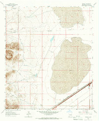
1964 Map of Mondel
USGS Topo · Published 1966About this map
The Butterfield Trail cuts through this high desert corridor, marking a legacy of mid-19th-century mail and passenger transport before more modern infrastructure arrived. By the mid-1960s, the Southern Pacific railroad and a major Pipeline followed a similar southwest-to-northeast trajectory, showing how the landscape's natural passes continued to dictate regional movement. The settlement of Mondel serves as a small waypoint along these transit lines.
Find a feature on this map
21 named features on this map. Tap any name to fly to it.
Don’t see what you’re looking for? This feature index may not catch every label — zoom into the map to look around manually.
Map Details
Editions of this 1964 Mondel Map
This is the sole edition of this map. No revisions or reprints were ever made.
Other maps of this area

1917 · San Simon
USGS Topo · 1:125,000

1926 · Orange Butte
USGS Topo · 1:62,500

1928 · Chenoweth
USGS Topo · 1:62,500

1950 · San Simon
USGS Topo · 1:62,500

1950 · Vanar
USGS Topo · 1:62,500

1951 · Vanar
USGS Topo · 1:62,500

1951 · San Simon
USGS Topo · 1:62,500

1954 · Silver City
USGS Topo · 1:250,000

1958 · Silver City
USGS Topo · 1:250,000

1962 · Silver City
USGS Topo · 1:250,000