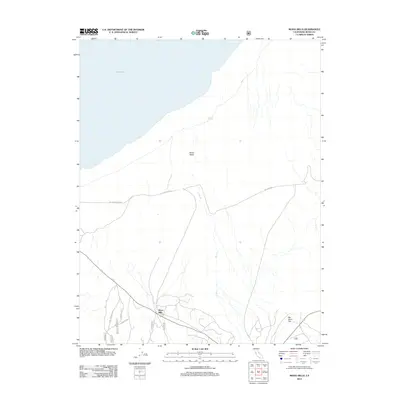
2012 Map of Mono Mills
USGS Topo · Published 2012About this map
Mono Mills serves as the focal point for this high-desert landscape in the eastern Sierra region, marking a site historically significant for its role in the local timber industry. The map illustrates the southern shore of Mono Lake and the broader expanse of the Mono Basin, where the terrain transitions into the distinct volcanic features of the area. Transportation routes such as the Mc Pherson Grade and the Mono Craters East road navigate the complex topography, providing access to remote locations like Simons Spring and the open stretch of Big Sand Flat. The seasonal drainage of Dry Cr underscores the arid character of the basin, while the network of forest roads including Craters Loop E and Craters Tie suggests a landscape managed for both utility and exploration. This 2012 survey by the U.S. Geological Survey reflects a modern state of the region's geography and infrastructure.
Find a feature on this map
11 named features on this map. Tap any name to fly to it.
Don’t see what you’re looking for? This feature index may not catch every label — zoom into the map to look around manually.
Map Details
Editions of this 2012 Mono Mills Map
This is the sole edition of this map. No revisions or reprints were ever made.
Other maps of this area

1901 · Mt. Lyell
USGS Topo · 1:125,000

1909 · Hawthorne
USGS Topo · 1:250,000

1909 · Bridgeport
USGS Topo · 1:125,000

1911 · Bridgeport
USGS Topo · 1:125,000

1911 · Hawthorne
USGS Topo · 1:250,000

1914 · Mt. Morrison
USGS Topo · 1:125,000

1915 · Hawthorne
USGS Topo · 1:250,000

1920 · Bridgeport
USGS Topo · 1:125,000

1947 · Mariposa
USGS Topo · 1:250,000

1948 · Walker Lake
USGS Topo · 1:250,000