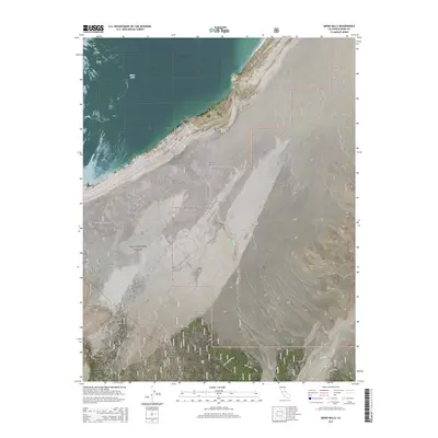
2015 Map of Mono Mills
USGS Topo · Published 2015About this map
The southern shoreline of Mono Lake meets the volcanic and industrial legacy of the high desert in this study of the Mono Basin. The map centers on the site of Mono Mills, situated along the Inyo National Forest boundary where timber was once processed for the silver mines of the region. A network of specialized roads and historical infrastructure, including the Mono Mills Connection and the Mono Mills Cutoff, trace the movement of goods and people across this arid landscape. To the south, an Old Railroad grade serves as a silent reminder of the transit lines that once connected these remote camps to larger markets. The terrain shifts from the alkaline edges of the lake to the prominent Big Sand Flat, while vital water sources like Simons Spring and Pilot Springs mark critical points in an otherwise parched environment defined by seasonal drainages like Dry Cr.
Find a feature on this map
21 named features on this map. Tap any name to fly to it.
Don’t see what you’re looking for? This feature index may not catch every label — zoom into the map to look around manually.
Map Details
Editions of this 2015 Mono Mills Map
This is the sole edition of this map. No revisions or reprints were ever made.
Other maps of this area

1901 · Mt. Lyell
USGS Topo · 1:125,000

1909 · Hawthorne
USGS Topo · 1:250,000

1909 · Bridgeport
USGS Topo · 1:125,000

1911 · Bridgeport
USGS Topo · 1:125,000

1911 · Hawthorne
USGS Topo · 1:250,000

1914 · Mt. Morrison
USGS Topo · 1:125,000

1915 · Hawthorne
USGS Topo · 1:250,000

1920 · Bridgeport
USGS Topo · 1:125,000

1947 · Mariposa
USGS Topo · 1:250,000

1948 · Walker Lake
USGS Topo · 1:250,000