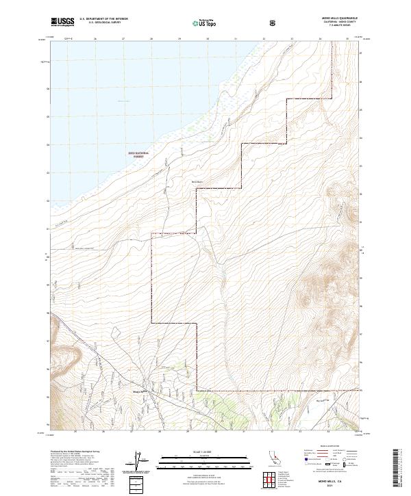
2021 Map of Mono Mills
USGS Topo · Published 2021About this map
Mono Mills serves as a central waypoint in this high-desert landscape, situated where the arid Mono Basin meets the forested slopes of the Inyo National Forest. The geography is defined by the transition from the southern shoreline of Mono Lake to the vast, open expanse of Big Sand Flat. Historical infrastructure is woven through the terrain, most notably the path of the Old Rail Road, which once supported the timber industry required by nearby silver mines. This network of transit is further represented by local routes like Sheep Tank Road and the steep Mc Pherson Grade. Small hydrologic features such as Simons Spring and Pilot Springs provide critical markers in an otherwise dry environment, illustrating the essential relationship between water sources and early settlement patterns in this part of Mono County.
Find a feature on this map
25 named features on this map. Tap any name to fly to it.
Don’t see what you’re looking for? This feature index may not catch every label — zoom into the map to look around manually.
Map Details
Editions of this 2021 Mono Mills Map
This is the sole edition of this map. No revisions or reprints were ever made.
Other maps of this area

1901 · Mt. Lyell
USGS Topo · 1:125,000

1909 · Hawthorne
USGS Topo · 1:250,000

1909 · Bridgeport
USGS Topo · 1:125,000

1911 · Bridgeport
USGS Topo · 1:125,000

1911 · Hawthorne
USGS Topo · 1:250,000

1914 · Mt. Morrison
USGS Topo · 1:125,000

1915 · Hawthorne
USGS Topo · 1:250,000

1920 · Bridgeport
USGS Topo · 1:125,000

1947 · Mariposa
USGS Topo · 1:250,000

1948 · Walker Lake
USGS Topo · 1:250,000