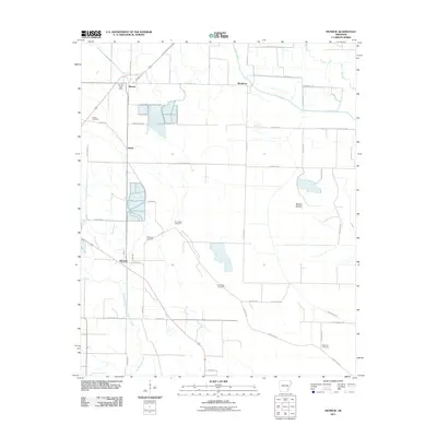
2011 Map of Monroe
USGS Topo · Published 2011About this map
The Monroe Post Office serves as a central landmark in this agricultural landscape of Lee County, where the settlement of Monroe and the surrounding hamlets of Buckhorn, Smale, and Blackton are connected by a grid of rural roads. The terrain is defined by low-lying wetlands and drainage networks, most notably Big Cypress Creek and the Piney Creek system, which feed into the broader Warrior Bottom basin. Family and community heritage is anchored by several burial grounds, including Bonds Cemetery, Whitehall Cemetery, and two locations for Pine Ridge Cemetery. Economic activity is evidenced by specialized infrastructure such as Minnow Farm Rd and Hog Farm Ln, highlighting the region's reliance on aquaculture and livestock during the early 21st century.
Find a feature on this map
40 named features on this map. Tap any name to fly to it.
Don’t see what you’re looking for? This feature index may not catch every label — zoom into the map to look around manually.
Map Details
Editions of this 2011 Monroe Map
This is the sole edition of this map. No revisions or reprints were ever made.
Other maps of this area

1940 · Marvell
USGS Topo · 1:62,500

1940 · Holly Grove
USGS Topo · 1:62,500

1940 · Brinkley
USGS Topo · 1:62,500

1940 · Marianna
USGS Topo · 1:62,500

1948 · Helena
USGS Topo · 1:250,000

1950 · Helena
USGS Topo · 1:250,000

1955 · Helena
USGS Topo · 1:250,000

1956 · Marvell
USGS Topo · 1:62,500
1957 · Marianna
USGS Topo · 1:62,500

1957 · Holly Grove
USGS Topo · 1:62,500