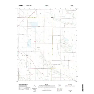
2020 Map of Monroe
USGS Topo · Published 2020About this map
Monroe and Blackton anchor this survey of the Arkansas delta, where Lee, Monroe, and Phillips counties meet. The landscape is defined by the drainage patterns of Piney Creek and Big Cypress Cr, which feed into the low-lying Cypress Swamp and the named wetlands of Warrior Bottom. This area reflects a long-standing agricultural tradition, with a network of local routes like Minnow Farm Rd, Hog Farm Ln, and Duck Club Rd that delineate the rural land use and provide access to the surrounding creek bottoms.
Find a feature on this map
55 named features on this map. Tap any name to fly to it.
Don’t see what you’re looking for? This feature index may not catch every label — zoom into the map to look around manually.
Map Details
Editions of this 2020 Monroe Map
This is the sole edition of this map. No revisions or reprints were ever made.
Other maps of this area

1940 · Marvell
USGS Topo · 1:62,500

1940 · Holly Grove
USGS Topo · 1:62,500

1940 · Brinkley
USGS Topo · 1:62,500

1940 · Marianna
USGS Topo · 1:62,500

1948 · Helena
USGS Topo · 1:250,000

1950 · Helena
USGS Topo · 1:250,000

1955 · Helena
USGS Topo · 1:250,000

1956 · Marvell
USGS Topo · 1:62,500
1957 · Marianna
USGS Topo · 1:62,500

1957 · Holly Grove
USGS Topo · 1:62,500