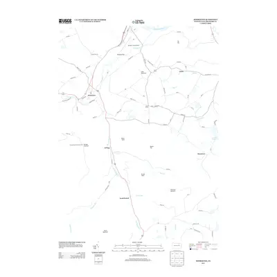
2013 Map of Monroeton
USGS Topo · Published 2013About this map
The Susquehanna River skirts the northern edge of this landscape, where the confluence with Towanda Cr creates the broad Towanda Flats. To the south, the terrain rises sharply into a series of peaks including Hale Mountain, Robwood Mountain, and Kellogg Mountain, the latter of which features the Kellogg Mountain Lookout Tower. The village of Monroeton serves as a central hub where the Berwick Tpke and several local routes converge near the creek. Smaller rural settlements like Liberty Corners, Kellogg, and Uhdey are connected by a network of named roads such as Grandma Hill Rd and Bierne Hill Rd. The southern portion of the quadrangle is defined by the valley of the S Br Towanda Cr, which passes through South Branch and provides a corridor for travel toward the surrounding highlands of Hatch Mountain and Marcy Point.
Find a feature on this map
76 named features on this map. Tap any name to fly to it.
Don’t see what you’re looking for? This feature index may not catch every label — zoom into the map to look around manually.
Map Details
Editions of this 2013 Monroeton Map
This is the sole edition of this map. No revisions or reprints were ever made.
Other maps of this area

1923 · Towanda
USGS Topo · 1:62,500

1926 · Towanda
USGS Topo · 1:62,500

1939 · Sayre
USGS Topo · 1:62,500

1942 · Sayre
USGS Topo · 1:62,500

1943 · Towanda
USGS Topo · 1:62,500

1943 · Monroeton
USGS Topo · 1:62,500

1943 · Powell
USGS Topo · 1:62,500

1945 · Powell
USGS Topo · 1:62,500

1948 · Sayre
USGS Topo · 1:62,500

1954 · Williamsport
USGS Topo · 1:250,000
Featured Places
- Wysox Township, PA
- Asylum Township, PA
- Towanda Township, PA
- South Branch, Monroe Township
- Albany Township, PA