
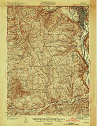
1942 Map of Sayre
USGS Topo · Published 1942About this map
The Susquehanna River and Chemung River converge in the northeast corner of this 1939 survey, framing the industrial and rail hub of Sayre and Athens. This area, just below the Pennsylvania New York Boundary Line, was a vital corridor for the Lehigh Valley railroad. The surrounding highlands of Bradford County are dotted with small farming hamlets and local landmarks like Spanish Hill and Burnham Hill.
Find a feature on this map
76 named features on this map. Tap any name to fly to it.
Don’t see what you’re looking for? This feature index may not catch every label — zoom into the map to look around manually.
Map Details
Editions of this 1942 Sayre Map
2 editions found
Other maps of this area

1895 · Elmira
USGS Topo · 1:62,500

1902 · Waverly
USGS Topo · 1:62,500

1903 · Owego
USGS Topo · 1:62,500

1905 · Watkins Glen
USGS Topo · 1:125,000

1906 · Catatonk
USGS Topo · 1:125,000

1923 · Towanda
USGS Topo · 1:62,500

1926 · Towanda
USGS Topo · 1:62,500

1931 · Troy
USGS Topo · 1:48,000

1938 · Troy
USGS Topo · 1:62,500

1939 · Sayre
USGS Topo · 1:62,500