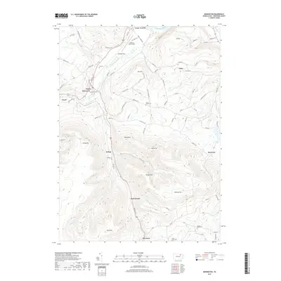
2019 Map of Monroeton
USGS Topo · Published 2019About this map
Towanda Creek and the S Br Towanda Cr anchor the valley floor in this Bradford County study, where small settlements like Monroeton and Kellogg are positioned at critical junctions of the river and road networks. The terrain is defined by prominent peaks including Kellogg Mtn and Robwood Mtn, which overlook the fertile Towanda Flats and the broader Susquehanna River valley to the north. For genealogists and local researchers, the map provides precise locations for several family and community burial grounds, such as Cole Cem, Scrivens Hollow Cem, and the Teeter Family Cem. The landscape reflects a mix of high-relief ridges and the agricultural lowlands surrounding the Bradford County Airport, capturing the modern infrastructure of this rural Pennsylvania region.
Find a feature on this map
97 named features on this map. Tap any name to fly to it.
Don’t see what you’re looking for? This feature index may not catch every label — zoom into the map to look around manually.
Map Details
Editions of this 2019 Monroeton Map
This is the sole edition of this map. No revisions or reprints were ever made.
Other maps of this area

1923 · Towanda
USGS Topo · 1:62,500

1926 · Towanda
USGS Topo · 1:62,500

1939 · Sayre
USGS Topo · 1:62,500

1942 · Sayre
USGS Topo · 1:62,500

1943 · Towanda
USGS Topo · 1:62,500

1943 · Monroeton
USGS Topo · 1:62,500

1943 · Powell
USGS Topo · 1:62,500

1945 · Powell
USGS Topo · 1:62,500

1948 · Sayre
USGS Topo · 1:62,500

1954 · Williamsport
USGS Topo · 1:250,000
Featured Places
- Wysox Township, PA
- Asylum Township, PA
- Towanda Township, PA
- South Branch, Monroe Township
- Albany Township, PA