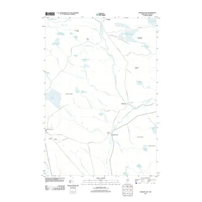
2011 Map of Monson East
USGS Topo · Published 2011About this map
Big Wilson Stream winds through a landscape of ridges and wetlands, anchoring the settlements of Willimantic and Goodell Corner in this Piscataquis County region. The terrain is defined by a dense network of water bodies, from the prominent Lake Onawa in the northeast to the uniquely named Eighteen Quarry Pond and Squankin Pond. For those researching local heritage, the map identifies three distinct burial grounds: Hillside Cemetery, Monson Cemetery, and Riverside Cemetery, reflecting the early communities that grew around the local streams and hills. Notable elevations like Greenwood Mountain and Davis Mountain rise above the valleys, while features such as Phillips Brooks Dam indicate the managed nature of the local hydrography during this era. The road network, including Elliottsville Rd and Willimantic Rd, connects these small settlements across the rocky Maine woods.
Find a feature on this map
67 named features on this map. Tap any name to fly to it.
Don’t see what you’re looking for? This feature index may not catch every label — zoom into the map to look around manually.
Map Details
Editions of this 2011 Monson East Map
This is the sole edition of this map. No revisions or reprints were ever made.
Other maps of this area

1933 · Guilford
USGS Topo · 1:62,500

1937 · Guilford
USGS Topo · 1:62,500

1948 · Kingsbury
USGS Topo · 1:62,500

1950 · Kingsbury
USGS Topo · 1:62,500

1950 · Sebec Lake
USGS Topo · 1:62,500

1951 · Greenville
USGS Topo · 1:62,500

1954 · Millinocket
USGS Topo · 1:250,000

1958 · Millinocket
USGS Topo · 1:250,000

1960 · Millinocket
USGS Topo · 1:250,000

1975 · Kingsbury NE
USGS Topo · 1:24,000