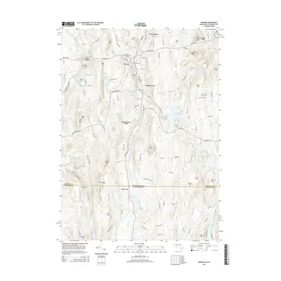
2015 Map of Monson
USGS Topo · Published 2015About this map
Monson serves as the central hub of this corridor where the valley of Chicopee Brook cuts through the high ground of south-central Massachusetts toward the Connecticut border. The landscape is defined by a dense network of water bodies and hills, including the expansive Conant Brook Reservoir and the heights of Peaked Mtn and Flynt Mtn. Settlement is concentrated along the north-south axis of Main ST and Palmer RD, linking North Monson through to South Monson and the historic South Factory Village. Genealogists will find significant local history preserved in a cluster of burial grounds, including the North Main Street Cem, Bethany Cem, and the more secluded Butler Cem near Peaked Mtn. The southern portion of the map shows the transition into Stafford, Connecticut, marked by the State Line and the headwaters of the Scantic River and Middle River.
Find a feature on this map
155 named features on this map. Tap any name to fly to it.
Don’t see what you’re looking for? This feature index may not catch every label — zoom into the map to look around manually.
Map Details
Editions of this 2015 Monson Map
This is the sole edition of this map. No revisions or reprints were ever made.
Other maps of this area

1887 · Brookfield
USGS Topo · 1:62,500

1887 · Palmer
USGS Topo · 1:62,500

1889 · Palmer
USGS Topo · 1:62,500

1890 · Brookfield
USGS Topo · 1:62,500

1892 · Woodstock
USGS Topo · 1:62,500

1892 · Tolland
USGS Topo · 1:62,500

1893 · Palmer
USGS Topo · 1:62,500

1893 · Brookfield
USGS Topo · 1:62,500

1908 · Ware
USGS Topo · 1:125,000

1915 · Brookfield
USGS Topo · 1:62,500