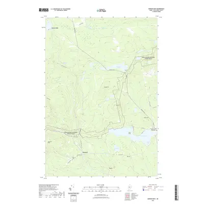
2021 Map of Monson West
USGS Topo · Published 2021About this map
The Appalachian National Scenic Trail cuts a distinct path through this Piscataquis County landscape, crossing the western heights of Breakneck Ridge before descending toward the village of Monson. This contemporary survey reveals the region's enduring settlement patterns, where small communities like Shirley Mills, Blanchard, and Parrot are connected by a network of rural roads such as Greenville Rd and the former rail corridor at B&A Railroad Rd S.
Find a feature on this map
42 named features on this map. Tap any name to fly to it.
Don’t see what you’re looking for? This feature index may not catch every label — zoom into the map to look around manually.
Map Details
Editions of this 2021 Monson West Map
This is the sole edition of this map. No revisions or reprints were ever made.
Other maps of this area

1933 · Guilford
USGS Topo · 1:62,500

1937 · Guilford
USGS Topo · 1:62,500

1948 · Kingsbury
USGS Topo · 1:62,500

1950 · Kingsbury
USGS Topo · 1:62,500

1950 · Sebec Lake
USGS Topo · 1:62,500

1951 · Greenville
USGS Topo · 1:62,500

1954 · Millinocket
USGS Topo · 1:250,000

1958 · Millinocket
USGS Topo · 1:250,000

1960 · Millinocket
USGS Topo · 1:250,000

1975 · Kingsbury NE
USGS Topo · 1:24,000