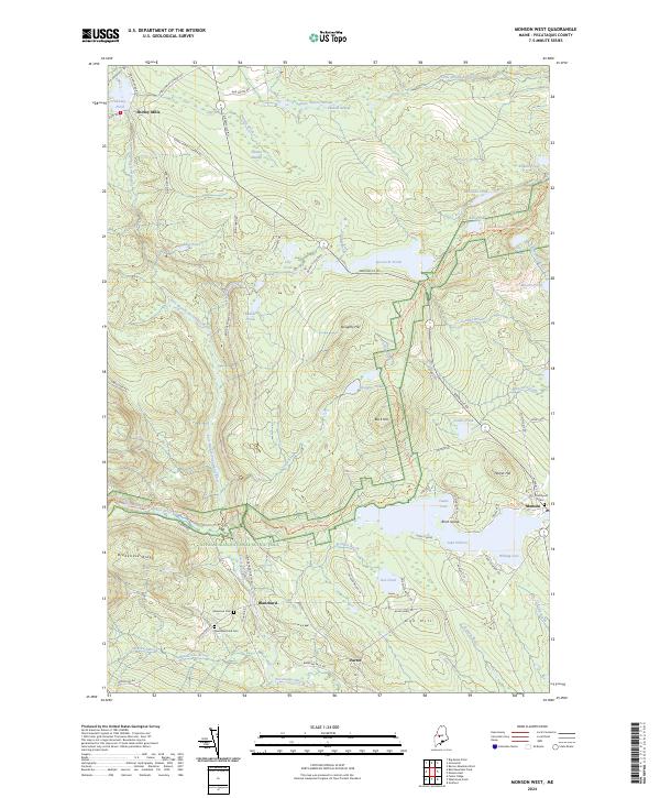
2024 Map of Monson West
USGS Topo · Published 2024About this map
Lake Hebron and its intricate shoreline, including Whiting Cove and Towne Cove, anchor the eastern edge of this Maine landscape near the village of Monson. The surrounding terrain is defined by a dense network of water bodies and streams, from Shirley Pond in the northwest to the winding path of the East Branch Piscataquis River. The modern presence of the Appalachian National Scenic Trail cuts across the center of the sheet, traversing high ground like Buck Hill and Breakneck Ridge. Genealogy and local history researchers will find the settlements of Shirley Mills, Blanchard, and Parrot well-documented, along with several burial sites such as Glenwood Cem and New Blanchard Cem. The conversion of the B&A Railroad Rd S corridor indicates the area's transition from early industrial rail reliance to modern recreational use and secondary road access.
Find a feature on this map
78 named features on this map. Tap any name to fly to it.
Don’t see what you’re looking for? This feature index may not catch every label — zoom into the map to look around manually.
Map Details
Editions of this 2024 Monson West Map
This is the sole edition of this map. No revisions or reprints were ever made.
Other maps of this area

1933 · Guilford
USGS Topo · 1:62,500

1937 · Guilford
USGS Topo · 1:62,500

1948 · Kingsbury
USGS Topo · 1:62,500

1950 · Kingsbury
USGS Topo · 1:62,500

1950 · Sebec Lake
USGS Topo · 1:62,500

1951 · Greenville
USGS Topo · 1:62,500

1954 · Millinocket
USGS Topo · 1:250,000

1958 · Millinocket
USGS Topo · 1:250,000

1960 · Millinocket
USGS Topo · 1:250,000

1975 · Kingsbury NE
USGS Topo · 1:24,000