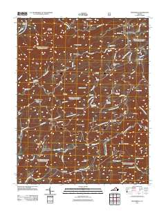
2011 Map of Montebello
USGS Topo · Published 2011About this map
Montebello and the surrounding high country of the Blue Ridge mountains are defined by a network of steep ridges and cold water resources. The Montebello State Fish Hatchery is a prominent landmark in the north, while the landscape further south is marked by peaks like Boston Mountain Boston Knob and the winding route of the Blue Ridge Pkwy. The area's extraction history is visible at the Irish Creek Mine, situated near the headwaters of Irish Creek.
Find a feature on this map
66 named features on this map. Tap any name to fly to it.
Don’t see what you’re looking for? This feature index may not catch every label — zoom into the map to look around manually.
Map Details
Editions of this 2011 Montebello Map
This is the sole edition of this map. No revisions or reprints were ever made.
Other maps of this area

1894 · Lexington
USGS Topo · 1:125,000

1932 · Lexington
USGS Topo · 1:48,000

1935 · Buena Vista
USGS Topo · 1:48,000

1935 · Amherst
USGS Topo · 1:48,000

1936 · Vesuvius
USGS Topo · 1:48,000

1937 · Lexington
USGS Topo · 1:62,500

1939 · Amherst
USGS Topo · 1:62,500

1939 · Buena Vista
USGS Topo · 1:62,500

1940 · Buena Vista
USGS Topo · 1:62,500

1941 · Vesuvius
USGS Topo · 1:62,500