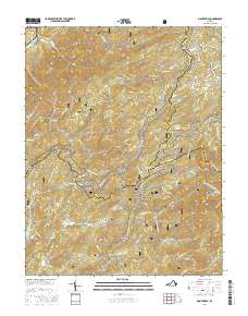
2016 Map of Montebello
USGS Topo · Published 2016About this map
Montebello sits at the high intersection of the Nelson Co and Rockbridge Co lines, serving as a gateway to the high ridgelines of the George Washington National Forest. This section of the Blue Ridge is defined by steep drainage basins and significant changes in elevation, where the Appalachian National Scenic Trail winds along the crests of Tar Jacket Ridge and Rocky Mtn. Small mountain communities like Irish Creek and Alto are situated along the lower valleys, connected by historic mountain passes such as Irish Gap and Salt Log Gap.
Find a feature on this map
82 named features on this map. Tap any name to fly to it.
Don’t see what you’re looking for? This feature index may not catch every label — zoom into the map to look around manually.
Map Details
Editions of this 2016 Montebello Map
This is the sole edition of this map. No revisions or reprints were ever made.
Other maps of this area

1894 · Lexington
USGS Topo · 1:125,000

1932 · Lexington
USGS Topo · 1:48,000

1935 · Buena Vista
USGS Topo · 1:48,000

1935 · Amherst
USGS Topo · 1:48,000

1936 · Vesuvius
USGS Topo · 1:48,000

1937 · Lexington
USGS Topo · 1:62,500

1939 · Amherst
USGS Topo · 1:62,500

1939 · Buena Vista
USGS Topo · 1:62,500

1940 · Buena Vista
USGS Topo · 1:62,500

1941 · Vesuvius
USGS Topo · 1:62,500