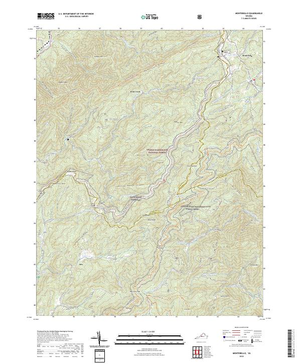
2022 Map of Montebello
USGS Topo · Published 2022About this map
The George Washington National Forest covers much of this high-elevation landscape, where the Blue Ridge Parkway winds through the mountains of Rockbridge, Nelson, and Amherst counties. At the northern edge, the community of Montebello serves as a local hub near Mount Paran Baptist Church and several family burial sites, including Grant Cem and Church Cem. The terrain is defined by prominent features like Whetstone Ridge and Painter Mtn, with the Appalachian National Scenic Trl tracing the crests southward toward Alto. This region’s geography highlights a historical reliance on high mountain passes and gaps, such as Irish Gap and Salt Log Gap, to navigate the drainage basins of the Irish Cr and the Pedlar River.
Find a feature on this map
83 named features on this map. Tap any name to fly to it.
Don’t see what you’re looking for? This feature index may not catch every label — zoom into the map to look around manually.
Map Details
Editions of this 2022 Montebello Map
This is the sole edition of this map. No revisions or reprints were ever made.
Other maps of this area

1894 · Lexington
USGS Topo · 1:125,000

1932 · Lexington
USGS Topo · 1:48,000

1935 · Buena Vista
USGS Topo · 1:48,000

1935 · Amherst
USGS Topo · 1:48,000

1936 · Vesuvius
USGS Topo · 1:48,000

1937 · Lexington
USGS Topo · 1:62,500

1939 · Amherst
USGS Topo · 1:62,500

1939 · Buena Vista
USGS Topo · 1:62,500

1940 · Buena Vista
USGS Topo · 1:62,500

1941 · Vesuvius
USGS Topo · 1:62,500