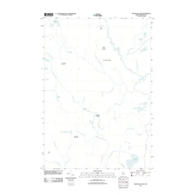
2011 Map of Montegail Pond
USGS Topo · Published 2011About this map
The Machias River and Mopang Stream systems dominate this interior Washington County landscape, revealing a remote wilderness shaped by timber and water. In the early 21st century, the area remains sparsely settled, centered on locations like Brewster Corner and the seasonal Pineo Camp. Significant water control is noted at Six Mile Dam on the Mopang, while the road network is defined by industrial passages such as Nash Timber Rd and Shadagee Ridge Rd. These routes provide access to a rugged interior of prominent heights, including Ben Tucker Mountain and Lower Buck Mountain. Numerous isolated water bodies like Montegail Pond, Hadley Lakes, and Black Brook Ponds underscore the glacial character of the region, where the Western Little River winds through a network of brooks and bogs typical of the Maine woods.
Find a feature on this map
39 named features on this map. Tap any name to fly to it.
Don’t see what you’re looking for? This feature index may not catch every label — zoom into the map to look around manually.
Map Details
Editions of this 2011 Montegail Pond Map
This is the sole edition of this map. No revisions or reprints were ever made.
Other maps of this area

1902 · Cherryfield
USGS Topo · 1:62,500

1904 · Cherryfield
USGS Topo · 1:62,500

1921 · Columbia Falls
USGS Topo · 1:62,500

1921 · Columbia Falls
USGS Topo · 1:62,500

1941 · Columbia Falls
USGS Topo · 1:62,500

1941 · Wesley
USGS Topo · 1:62,500

1941 · Tug Mountain
USGS Topo · 1:62,500

1942 · Cherryfield
USGS Topo · 1:62,500

1942 · Columbia Falls
USGS Topo · 1:62,500

1943 · Tug Mountain
USGS Topo · 1:62,500