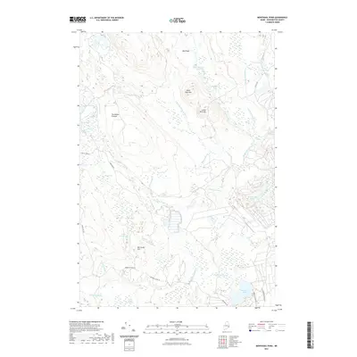
2021 Map of Montegail Pond
USGS Topo · Published 2021About this map
The Machias River and its numerous tributaries dominate this part of Washington County, creating a complex network of wetlands and rapids. The landscape is defined by its distinct water features, from the large Montegail Pond at the southern edge to the specialized terminology of the river itself, including Penman Rips and Machias Eddy. Terrain features such as Bald Head, Upper Buck Mtn, and Lower Buck Mtn rise above the surrounding heaths, including the expansive Big Heath and Brandy Heath.
Find a feature on this map
47 named features on this map. Tap any name to fly to it.
Don’t see what you’re looking for? This feature index may not catch every label — zoom into the map to look around manually.
Map Details
Editions of this 2021 Montegail Pond Map
This is the sole edition of this map. No revisions or reprints were ever made.
Other maps of this area

1902 · Cherryfield
USGS Topo · 1:62,500

1904 · Cherryfield
USGS Topo · 1:62,500

1921 · Columbia Falls
USGS Topo · 1:62,500

1921 · Columbia Falls
USGS Topo · 1:62,500

1941 · Columbia Falls
USGS Topo · 1:62,500

1941 · Wesley
USGS Topo · 1:62,500

1941 · Tug Mountain
USGS Topo · 1:62,500

1942 · Cherryfield
USGS Topo · 1:62,500

1942 · Columbia Falls
USGS Topo · 1:62,500

1943 · Tug Mountain
USGS Topo · 1:62,500