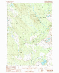
1990 Map of Montegail Pond
USGS Topo · Published 1990About this map
Columbia Falls Air Force Station dominates the eastern landscape of this Washington County interior, a Cold War-era installation also marked on the map by its acronym Cfafs. The area is defined by a dense network of waterways feeding the Machias River, including Montegail Stream and the expansive Montegail Pond. The topography transitions from low-lying bogs like Brandy Heath and Big Heath to distinct summits such as Ben Tucker Mountain and the curiously named Haunted Bald Head.
Find a feature on this map
52 named features on this map. Tap any name to fly to it.
Don’t see what you’re looking for? This feature index may not catch every label — zoom into the map to look around manually.
Map Details
Editions of this 1990 Montegail Pond Map
This is the sole edition of this map. No revisions or reprints were ever made.
Other maps of this area

1902 · Cherryfield
USGS Topo · 1:62,500

1904 · Cherryfield
USGS Topo · 1:62,500

1921 · Columbia Falls
USGS Topo · 1:62,500

1921 · Columbia Falls
USGS Topo · 1:62,500

1941 · Columbia Falls
USGS Topo · 1:62,500

1941 · Wesley
USGS Topo · 1:62,500

1941 · Tug Mountain
USGS Topo · 1:62,500

1942 · Cherryfield
USGS Topo · 1:62,500

1942 · Columbia Falls
USGS Topo · 1:62,500

1943 · Tug Mountain
USGS Topo · 1:62,500