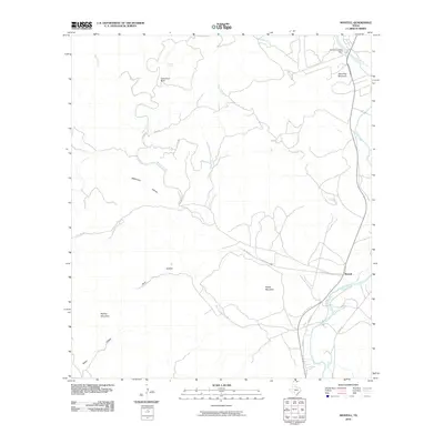
2010 Map of Montell
USGS Topo · Published 2010About this map
The Nueces River snakes through this portion of Uvalde County, carving a path alongside the settlement of Montell. This landscape is defined by its dramatic limestone relief and seasonal watercourses, where features like Cow Cave Bluff and Shoe Peg Mountain rise above the drainage basins of Montell Creek and Silver Creek. The presence of Fat Hog Spring near the northern boundary suggests the vital role of natural water sources in this arid environment, while the Arnold Crossing Dam on the river indicates efforts to manage the flow for local needs. Transportation is limited to a network of rural routes, including Cty Rd 415 and Uvalde 411, which connect the scattered holdings and landmarks like Hayes Mountain and Boiling Mountain. The map reveals a place where human activity, centered around the river and road crossings, remains closely tied to the difficult terrain of the Texas Hill Country.
Find a feature on this map
24 named features on this map. Tap any name to fly to it.
Don’t see what you’re looking for? This feature index may not catch every label — zoom into the map to look around manually.
Map Details
Editions of this 2010 Montell Map
This is the sole edition of this map. No revisions or reprints were ever made.
Other maps of this area

1893 · Nueces
USGS Topo · 1:125,000

1896 · Nueces
USGS Topo · 1:125,000

1896 · Brackett
USGS Topo · 1:125,000

1897 · Brackett
USGS Topo · 1:125,000

1898 · Uvalde
USGS Topo · 1:125,000

1899 · Uvalde
USGS Topo · 1:125,000

1938 · Turkey Mountain
USGS Topo · 1:48,000

1943 · Turkey Mountain
USGS Topo · 1:62,500

1944 · Barksdale
USGS Topo · 1:62,500

1954 · San Antonio
USGS Topo · 1:250,000