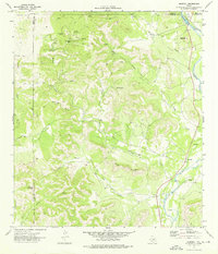
1973 Map of Montell
USGS Topo · Published 1976About this map
Nueces River valley life in the early 1970s is defined by its seasonal water sources and the varied topography at the intersection of several Texas counties. The small settlement of Montell sits near the riverbanks, where the landscape transitions from the open water of Nueces Lake to a network of winding draws and hollows. The area is heavily marked by natural landmarks with distinctive local names, including Shoe Peg Mountain and Hayes Mountain.
Find a feature on this map
33 named features on this map. Tap any name to fly to it.
Don’t see what you’re looking for? This feature index may not catch every label — zoom into the map to look around manually.
Map Details
Editions of this 1973 Montell Map
This is the sole edition of this map. No revisions or reprints were ever made.
Other maps of this area

1893 · Nueces
USGS Topo · 1:125,000

1896 · Nueces
USGS Topo · 1:125,000

1896 · Brackett
USGS Topo · 1:125,000

1897 · Brackett
USGS Topo · 1:125,000

1898 · Uvalde
USGS Topo · 1:125,000

1899 · Uvalde
USGS Topo · 1:125,000

1938 · Turkey Mountain
USGS Topo · 1:48,000

1943 · Turkey Mountain
USGS Topo · 1:62,500

1944 · Barksdale
USGS Topo · 1:62,500

1954 · San Antonio
USGS Topo · 1:250,000