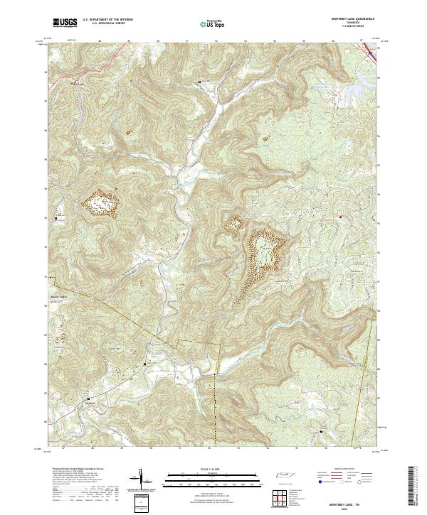
2022 Map of Monterey Lake
USGS Topo · Published 2022About this map
The Calfkiller River carves a central path through this section of the Cumberland Plateau, where the borders of Putnam, White, and Cumberland counties meet. The landscape is defined by its numerous named hollows and coves, including Round Cove, England Cove, and Stamps Hollow, which have long dictated the patterns of settlement and transit in this part of Tennessee. Small communities such as Mill Creek, Board Valley, and Taylors are situated along the valley floors and lower ridges, reflecting the traditional rural character of the region. Genealogists will find several family-named burial sites documented, such as Henry Cem, France Cem, and Crouse Cem. The northeastern corner is notable for Monterey Lake Number One, while the southern reaches contain landmarks like France Mtn and Cave Hill. This contemporary survey also tracks modern developments in the Cumberland Cove residential area, juxtaposing established family landmarks with newer road networks.
Find a feature on this map
90 named features on this map. Tap any name to fly to it.
Don’t see what you’re looking for? This feature index may not catch every label — zoom into the map to look around manually.
Map Details
Editions of this 2022 Monterey Lake Map
This is the sole edition of this map. No revisions or reprints were ever made.
Other maps of this area

1892 · Pikeville
USGS Topo · 1:125,000

1895 · Pikeville
USGS Topo · 1:125,000

1897 · Standingstone
USGS Topo · 1:125,000

1898 · Standingstone
USGS Topo · 1:125,000

1912 · Crossville
USGS Topo · 1:62,500

1935 · Campbell Junction
USGS Topo · 1:24,000

1943 · Cookeville
USGS Topo · 1:100,000

1944 · Cookeville
USGS Topo · 1:100,000

1946 · Campbell Junction
USGS Topo · 1:24,000

1946 · Obey City
USGS Topo · 1:24,000