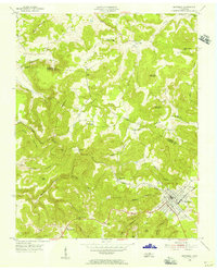
1955 Map of Monterey Lake
USGS Topo · Published 1956About this map
Monterey serves as the primary hub on this mid-century survey, situated at the intersection of rugged plateau terrain and the Tennessee Central railroad line. The landscape is defined by deep incisions like Walker Hollow and Obe Lee Hollow, which separate prominent elevations such as Kitty Ray Mountain and Table Rock Mountain. This 1955 field check reveals a dispersed rural society reliant on local institutions, evidenced by the numerous country schools and churches dotting the ridges and coves, including Shady Grove Sch and Cedar Springs Ch.
Find a feature on this map
44 named features on this map. Tap any name to fly to it.
Don’t see what you’re looking for? This feature index may not catch every label — zoom into the map to look around manually.
Map Details
Editions of this 1955 Monterey Lake Map
This is the sole edition of this map. No revisions or reprints were ever made.
Other maps of this area

1892 · Pikeville
USGS Topo · 1:125,000

1895 · Pikeville
USGS Topo · 1:125,000

1897 · Standingstone
USGS Topo · 1:125,000

1898 · Standingstone
USGS Topo · 1:125,000

1912 · Crossville
USGS Topo · 1:62,500

1935 · Campbell Junction
USGS Topo · 1:24,000

1943 · Cookeville
USGS Topo · 1:100,000

1944 · Cookeville
USGS Topo · 1:100,000

1946 · Campbell Junction
USGS Topo · 1:24,000

1946 · Obey City
USGS Topo · 1:24,000