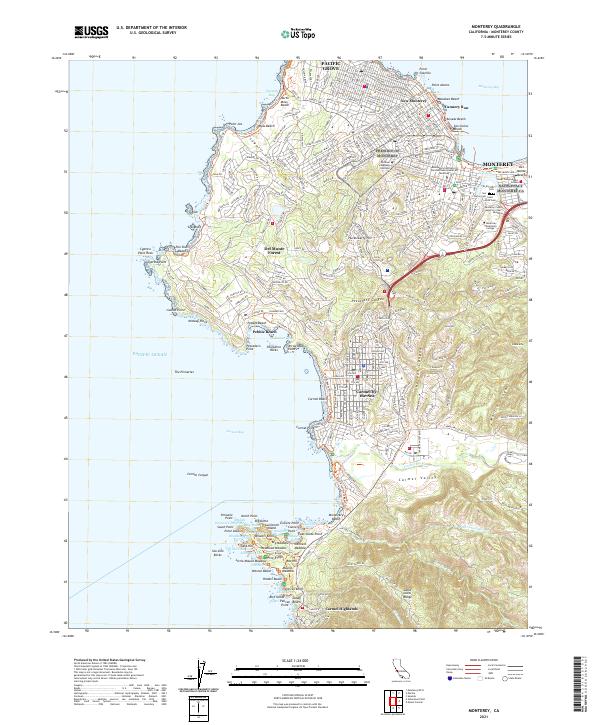
2021 Map of Monterey
USGS Topo · Published 2021About this map
Monterey and its surrounding coastal communities are meticulously documented in this 2021 study, highlighting the dense urban core and the famous waterfront of Cannery Row. The transition from the industrial legacy of the bayfront to the prestigious academic and military institutions like the Naval Postgraduate School and the Defense Language Institute defines the eastern shoreline. To the south, the landscape shifts toward the planned communities and world-renowned coastline of Del Monte Forest and Pebble Beach, where Cypress Point and Stillwater Cove mark the rugged Pacific edge.
Find a feature on this map
100 named features on this map. Tap any name to fly to it.
Don’t see what you’re looking for? This feature index may not catch every label — zoom into the map to look around manually.
Map Details
Editions of this 2021 Monterey Map
This is the sole edition of this map. No revisions or reprints were ever made.
Other maps of this area

1913 · Monterey
USGS Topo · 1:62,500

1918 · Point Sur
USGS Topo · 1:62,500

1925 · Point Sur
USGS Topo · 1:62,500

1941 · Monterey
USGS Topo · 1:62,500

1947 · Point Sur
USGS Topo · 1:62,500

1947 · Seaside
USGS Topo · 1:24,000

1947 · Monterey
USGS Topo · 1:62,500
1947 · Marina
USGS Topo · 1:24,000

1947 · Monterey
USGS Topo · 1:24,000

1948 · Santa Cruz
USGS Topo · 1:250,000