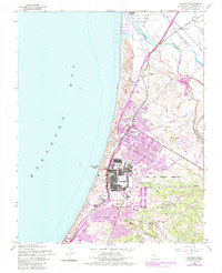
1947 Map of Marina
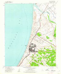
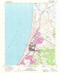
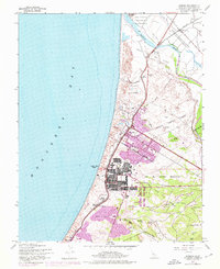
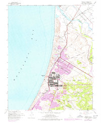
USGS Topo · Published 1961About this map
Fort Ord Military Reservation dominates the landscape of this mid-century survey, showcasing the expansive grid of barracks and training grounds that served as a major deployment center. Along the shoreline of Monterey Bay, the Southern Pacific railroad corridor threads through the dunes, linking coastal stops like Neponset and Lapis Siding to the interior. The map captures the agricultural and military infrastructure of the era, from the old land grants of Rincon de las Salinas to the rural Rincon Sch.
Find a feature on this map
30 named features on this map. Tap any name to fly to it.
Don’t see what you’re looking for? This feature index may not catch every label — zoom into the map to look around manually.
Map Details
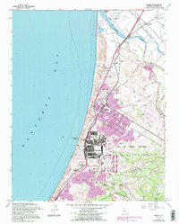
Editions of this 1947 Marina Map
6 editions found
Other maps of this area

1910 · Salinas
USGS Topo · 1:31,680

1912 · Salinas
USGS Topo · 1:62,500

1912 · Capitola
USGS Topo · 1:62,500

1913 · Monterey
USGS Topo · 1:62,500

1914 · Capitola
USGS Topo · 1:62,500

1915 · San Juan Bautista
USGS Topo · 1:48,000

1917 · San Juan Bautista
USGS Topo · 1:62,500

1939 · San Juan Bautista
USGS Topo · 1:62,500

1940 · San Juan Bautista
USGS Topo · 1:62,500

1940 · Salinas
USGS Topo · 1:62,500