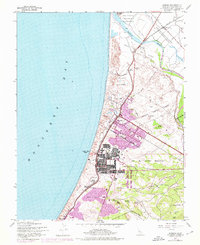
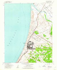
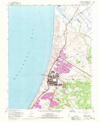
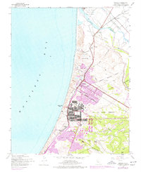
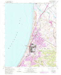
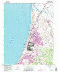
1947 Map of Marina
USGS Topo · Published 1976About this map
Fort Ord Military Reservation dominates the southern landscape of this 1947 coastal survey, illustrating the significant military footprint along Monterey Bay during the post-war years. The complex grid of barracks and training grounds stands in contrast to the developing community of Marina, where 1968 revisions (shown in purple) reveal significant urban expansion and the addition of a Drive-in Theater. Further inland, the map captures the transition from military use to local recreation at the Fort Ord Golf Course.
Find a feature on this map
34 named features on this map. Tap any name to fly to it.
Don’t see what you’re looking for? This feature index may not catch every label — zoom into the map to look around manually.
Map Details
Editions of this 1947 Marina Map
6 editions found
Other maps of this area

1910 · Salinas
USGS Topo · 1:31,680

1912 · Salinas
USGS Topo · 1:62,500

1912 · Capitola
USGS Topo · 1:62,500

1913 · Monterey
USGS Topo · 1:62,500

1914 · Capitola
USGS Topo · 1:62,500

1915 · San Juan Bautista
USGS Topo · 1:48,000

1917 · San Juan Bautista
USGS Topo · 1:62,500

1939 · San Juan Bautista
USGS Topo · 1:62,500

1940 · San Juan Bautista
USGS Topo · 1:62,500

1940 · Salinas
USGS Topo · 1:62,500