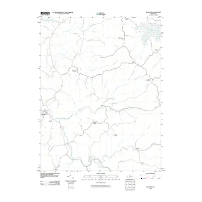
2010 Map of Monterey
USGS Topo · Published 2010About this map
Monterey serves as the primary hub in this corner of Owen County, where the hills are carved by an intricate network of waterways including Severn Creek, Cedar Creek, and Sawdridge Creek. The landscape is defined by its rural density, marked by numerous small cemeteries and church grounds that point to generations of family settlement. Notable among these are the Pauper Cemetery in the north and the Sanders Cemetery near the main town. Movement through the area follows the terrain, with routes like Us HWY 127 and Old Frankfort Pike connecting the smaller settlements of Hesler, New, and Teresita. The topographic detail reveals a series of prominent elevations such as Claxon Ridge and Paytons Ridge, which dictate the winding paths of the local road system and separate the various creek valleys that drain toward the Kentucky River basin.
Find a feature on this map
53 named features on this map. Tap any name to fly to it.
Don’t see what you’re looking for? This feature index may not catch every label — zoom into the map to look around manually.
Map Details
Editions of this 2010 Monterey Map
This is the sole edition of this map. No revisions or reprints were ever made.
Other maps of this area

1906 · Lockport
USGS Topo · 1:48,000

1908 · Lockport
USGS Topo · 1:62,500

1939 · Sadieville
USGS Topo · 1:62,500

1950 · New Liberty
USGS Topo · 1:24,000

1950 · Owenton
USGS Topo · 1:24,000

1950 · Lawrenceville
USGS Topo · 1:24,000

1953 · Monterey
USGS Topo · 1:24,000

1953 · Gratz
USGS Topo · 1:24,000

1953 · Polsgrove
USGS Topo · 1:24,000
1953 · Stamping Ground
USGS Topo · 1:24,000