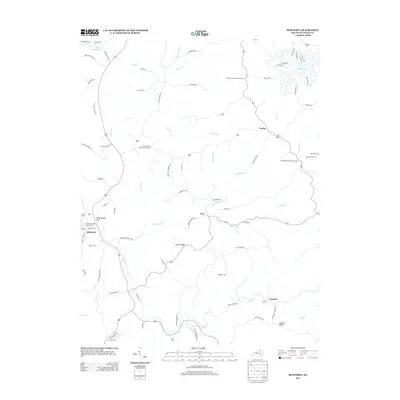
2013 Map of Monterey
USGS Topo · Published 2013About this map
Monterey serves as the primary hub for this Owen County landscape, situated along the path of Old Frankfort Pike and Old US Highway 127. The area is characterized by a dense network of cemeteries and rural churches, including the Monterey Baptist Church Cem and the Richland Baptist Church Cem, which anchor the small community nodes of Hesler and New. These sites, along with family-named locations like Perkins Cem and Sanders Cem, suggest deep-rooted generational ties to the local land.
Find a feature on this map
84 named features on this map. Tap any name to fly to it.
Don’t see what you’re looking for? This feature index may not catch every label — zoom into the map to look around manually.
Map Details
Editions of this 2013 Monterey Map
This is the sole edition of this map. No revisions or reprints were ever made.
Other maps of this area

1906 · Lockport
USGS Topo · 1:48,000

1908 · Lockport
USGS Topo · 1:62,500

1939 · Sadieville
USGS Topo · 1:62,500

1950 · New Liberty
USGS Topo · 1:24,000

1950 · Owenton
USGS Topo · 1:24,000

1950 · Lawrenceville
USGS Topo · 1:24,000

1953 · Monterey
USGS Topo · 1:24,000

1953 · Gratz
USGS Topo · 1:24,000

1953 · Polsgrove
USGS Topo · 1:24,000
1953 · Stamping Ground
USGS Topo · 1:24,000