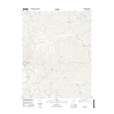
2016 Map of Monterey
USGS Topo · Published 2016About this map
Monterey Cem and the surrounding heights of Honeysuckle Hill overlook the creek valleys of Owen County in this modern survey. The landscape is defined by the winding paths of Severn Cr and Sawdridge Creek, where small settlements like Hesler and Teresita are connected by a network of rural roads. Genealogists will find a high density of burial sites and country congregations, including the Monterey Baptist Church Cem, Richland Baptist Church Cem, and the El Bethel Christian Church Cem. The terrain is marked by distinctive elevations such as Claxon Ridge and Paytons Ridge, falling away toward Craddock Bottom. In the northern reach, Elmer Davis Lake provides a major water feature among the many tributaries like Slippery Rock Cr and Greenup Cr that carve through the Kentucky hills.
Find a feature on this map
68 named features on this map. Tap any name to fly to it.
Don’t see what you’re looking for? This feature index may not catch every label — zoom into the map to look around manually.
Map Details
Editions of this 2016 Monterey Map
This is the sole edition of this map. No revisions or reprints were ever made.
Other maps of this area

1906 · Lockport
USGS Topo · 1:48,000

1908 · Lockport
USGS Topo · 1:62,500

1939 · Sadieville
USGS Topo · 1:62,500

1950 · New Liberty
USGS Topo · 1:24,000

1950 · Owenton
USGS Topo · 1:24,000

1950 · Lawrenceville
USGS Topo · 1:24,000

1953 · Monterey
USGS Topo · 1:24,000

1953 · Gratz
USGS Topo · 1:24,000

1953 · Polsgrove
USGS Topo · 1:24,000
1953 · Stamping Ground
USGS Topo · 1:24,000