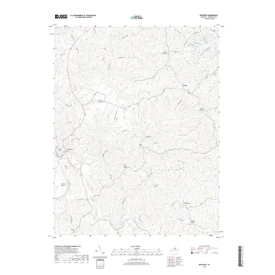
2019 Map of Monterey
USGS Topo · Published 2019About this map
Monterey Baptist Church Cem and the nearby Monterey Cem sit at the western edge of this Owen County landscape, where the terrain transitions into a dense network of ridges and deep creek bottoms. The geography is defined by the winding paths of Sawdridge Creek and Elk Lick Cr, which carve through the uplands to create prominent features like Claxon Ridge and the broad Craddock Bottom.
Find a feature on this map
75 named features on this map. Tap any name to fly to it.
Don’t see what you’re looking for? This feature index may not catch every label — zoom into the map to look around manually.
Map Details
Editions of this 2019 Monterey Map
This is the sole edition of this map. No revisions or reprints were ever made.
Other maps of this area

1906 · Lockport
USGS Topo · 1:48,000

1908 · Lockport
USGS Topo · 1:62,500

1939 · Sadieville
USGS Topo · 1:62,500

1950 · New Liberty
USGS Topo · 1:24,000

1950 · Owenton
USGS Topo · 1:24,000

1950 · Lawrenceville
USGS Topo · 1:24,000

1953 · Monterey
USGS Topo · 1:24,000

1953 · Gratz
USGS Topo · 1:24,000

1953 · Polsgrove
USGS Topo · 1:24,000
1953 · Stamping Ground
USGS Topo · 1:24,000