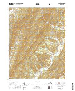
2019 Map of Monterey SE
USGS Topo · Published 2019About this map
The Bullpasture River carves a central path through this section of Highland County, anchoring a landscape defined by sharp ridges and narrow agricultural valleys. The small settlement of Clover Creek sits at a bend in the river, connected by State Rte 678 to the surrounding highlands. This area is characterized by massive physical landmarks like Sounding Knob and the long spine of Jack Mountain, which dominate the western horizon. To the north, the community of Vanderpool marks the headwaters of the Jackson River system just off the map edge.
Find a feature on this map
43 named features on this map. Tap any name to fly to it.
Don’t see what you’re looking for? This feature index may not catch every label — zoom into the map to look around manually.
Map Details
Editions of this 2019 Monterey SE Map
This is the sole edition of this map. No revisions or reprints were ever made.
Other maps of this area

1894 · Staunton
USGS Topo · 1:125,000

1901 · Monterey
USGS Topo · 1:125,000

1924 · Mc Dowell
USGS Topo · 1:62,500

1941 · Monterey
USGS Topo · 1:62,500

1943 · Craigsville
USGS Topo · 1:62,500

1944 · Monterey
USGS Topo · 1:62,500

1944 · Mc Dowell
USGS Topo · 1:62,500

1945 · Craigsville
USGS Topo · 1:62,500

1946 · Mc Dowell
USGS Topo · 1:62,500

1946 · Williamsville
USGS Topo · 1:62,500