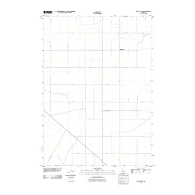
2010 Map of Monteview
USGS Topo · Published 2010About this map
Monteview sits as a central settlement within this high-desert landscape, defined by a rigid grid of rural roads and the essential infrastructure of water management. The agricultural character of the region is evident through the path of the North Lake Canal, which cuts laterally across the southern portion of the quadrangle, and the McKevitt Ditch in the east. These irrigation features are the lifeblood of the Idaho plain, supporting the surveyed sections that stretch between E Monument Line Rd and the meticulously numbered north-south routes. The layout reveals a late 20th-century development of the Snake River Plain, where the natural terrain has been systematically organized into productive acreage through coordinated engineering.
Find a feature on this map
18 named features on this map. Tap any name to fly to it.
Don’t see what you’re looking for? This feature index may not catch every label — zoom into the map to look around manually.
Map Details
Editions of this 2010 Monteview Map
This is the sole edition of this map. No revisions or reprints were ever made.
Other maps of this area

1955 · Dubois
USGS Topo · 1:250,000

1955 · Idaho Falls
USGS Topo · 1:250,000

1958 · Dubois
USGS Topo · 1:250,000

1958 · Idaho Falls
USGS Topo · 1:250,000

1964 · Terreton
USGS Topo · 1:24,000

1964 · Cedar Butte SW
USGS Topo · 1:24,000

1964 · Mud Lake NW
USGS Topo · 1:24,000

1969 · Lidy Hot Springs SE
USGS Topo · 1:24,000

1969 · Antelope Butte
USGS Topo · 1:24,000

1969 · Circular Butte
USGS Topo · 1:24,000