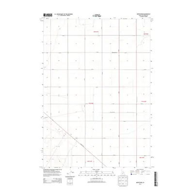
2013 Map of Monteview
USGS Topo · Published 2013About this map
Monteview serves as the primary landmark in this section of Jefferson County, Idaho, where the high desert landscape meets a structured network of agricultural infrastructure. The settlement is positioned along an organized grid of section-line roads, such as E 2400 N and E 2500 N, reflecting the systematic township and range development typical of this region. The survival of this community is intrinsically linked to water management, as evidenced by the presence of the McKevitt Ditch and the North Lake Canal. These man-made watercourses, along with the 23N Lake Canal, illustrate the engineering efforts required to sustain cultivation in this arid environment. Further south, the landscape is bisected by the diagonal path of the N Salmon Hwy, which provides a vital transit link across the basin, meeting the western-reaching Cutoff Rd.
Find a feature on this map
20 named features on this map. Tap any name to fly to it.
Don’t see what you’re looking for? This feature index may not catch every label — zoom into the map to look around manually.
Map Details
Editions of this 2013 Monteview Map
This is the sole edition of this map. No revisions or reprints were ever made.
Other maps of this area

1955 · Dubois
USGS Topo · 1:250,000

1955 · Idaho Falls
USGS Topo · 1:250,000

1958 · Dubois
USGS Topo · 1:250,000

1958 · Idaho Falls
USGS Topo · 1:250,000

1964 · Terreton
USGS Topo · 1:24,000

1964 · Cedar Butte SW
USGS Topo · 1:24,000

1964 · Mud Lake NW
USGS Topo · 1:24,000

1969 · Lidy Hot Springs SE
USGS Topo · 1:24,000

1969 · Antelope Butte
USGS Topo · 1:24,000

1969 · Circular Butte
USGS Topo · 1:24,000