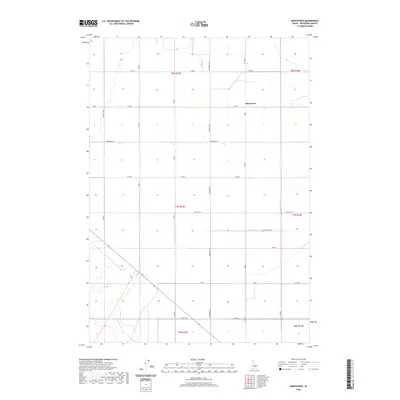
2020 Map of Monteview
USGS Topo · Published 2020About this map
Monteview stands as the primary settlement in this agricultural section of Jefferson County, Idaho. The landscape is defined by a rigorous grid of section lines and irrigation infrastructure essential for high-desert farming, including the North Lake Canal and the McKevitt Ditch. This 2020 survey reveals a community organized around a network of gravel and paved routes such as Schwendig Rd and Wadsworth Rd, which facilitate transport through the surrounding township and range blocks. The map provides a clear look at the intersection of water management and local geography, where named thoroughfares like Mitchell Rd and Staley Rd segment the territory into productive parcels. For the local historian or genealogist, the map preserves the specific placement of farmstead access and irrigation feeders that have sustained this rural community for generations.
Find a feature on this map
26 named features on this map. Tap any name to fly to it.
Don’t see what you’re looking for? This feature index may not catch every label — zoom into the map to look around manually.
Map Details
Editions of this 2020 Monteview Map
This is the sole edition of this map. No revisions or reprints were ever made.
Other maps of this area

1955 · Dubois
USGS Topo · 1:250,000

1955 · Idaho Falls
USGS Topo · 1:250,000

1958 · Dubois
USGS Topo · 1:250,000

1958 · Idaho Falls
USGS Topo · 1:250,000

1964 · Terreton
USGS Topo · 1:24,000

1964 · Cedar Butte SW
USGS Topo · 1:24,000

1964 · Mud Lake NW
USGS Topo · 1:24,000

1969 · Lidy Hot Springs SE
USGS Topo · 1:24,000

1969 · Antelope Butte
USGS Topo · 1:24,000

1969 · Circular Butte
USGS Topo · 1:24,000