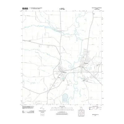
2011 Map of Montezuma
USGS Topo · Published 2011About this map
The Flint River serves as the central artery for this part of Georgia, dividing the twin cities of Montezuma and Oglethorpe. Historically tied by the river and railroad, these communities are detailed during a period of modern stability, showing the infrastructure of the Montezuma Post Office and Oglethorpe Post Office. The landscape is defined by its water management and agricultural drainage, visible in the numerous controlled bodies of water like Whitewater Pond and Chase Lake, both featuring early 21st-century dam structures. Local history is anchored by several burial grounds, including Felton Cemetery and the Oglethorpe Cemetery. Beyond the urban centers, the map documents the surrounding rural landscape, from the aviation facilities at the Dr C P Savage Senior Airport to the outlying settlement at Travelers Rest. The presence of the Macon Lookout Tower in the northeast corner provides a look at the region's forestry and fire management history.
Find a feature on this map
65 named features on this map. Tap any name to fly to it.
Don’t see what you’re looking for? This feature index may not catch every label — zoom into the map to look around manually.
Map Details
Editions of this 2011 Montezuma Map
This is the sole edition of this map. No revisions or reprints were ever made.
Other maps of this area

1955 · Phenix City
USGS Topo · 1:250,000

1957 · Phenix City
USGS Topo · 1:250,000

1957 · Macon
USGS Topo · 1:250,000

1958 · Macon
USGS Topo · 1:250,000

1958 · Phenix City
USGS Topo · 1:250,000

1964 · Macon
USGS Topo · 1:250,000

1971 · Ideal South
USGS Topo · 1:24,000

1971 · Ideal North
USGS Topo · 1:24,000

1971 · Garden Valley
USGS Topo · 1:24,000

1971 · Montezuma
USGS Topo · 1:24,000