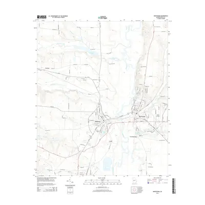
2014 Map of Montezuma
USGS Topo · Published 2014About this map
The Flint River corridor serves as the central artery for this portion of Macon County, where the sister cities of Montezuma and Oglethorpe face each other across the water. This 2014 survey documents the dense network of county roads and state highways, including Ga-49, that connect these historic river towns. The landscape is defined by the convergence of several major tributaries, including Whitewater Creek, Buck Creek, and Beaver Creek, which feed into the main river channel. Local history and genealogy are well-represented by sites such as the Oglethorpe Cem, Felton Cem, and the settlement of Travelers Rest, which includes the Travelers Rest Cem. The map also captures specialized land use in the area, from the Dr C P Savage Sr Airport to the Macon Lookout Tower in the northern reaches, illustrating the modern rural and municipal infrastructure of middle Georgia.
Find a feature on this map
123 named features on this map. Tap any name to fly to it.
Don’t see what you’re looking for? This feature index may not catch every label — zoom into the map to look around manually.
Map Details
Editions of this 2014 Montezuma Map
This is the sole edition of this map. No revisions or reprints were ever made.
Other maps of this area

1955 · Phenix City
USGS Topo · 1:250,000

1957 · Phenix City
USGS Topo · 1:250,000

1957 · Macon
USGS Topo · 1:250,000

1958 · Macon
USGS Topo · 1:250,000

1958 · Phenix City
USGS Topo · 1:250,000

1964 · Macon
USGS Topo · 1:250,000

1971 · Ideal South
USGS Topo · 1:24,000

1971 · Ideal North
USGS Topo · 1:24,000

1971 · Garden Valley
USGS Topo · 1:24,000

1971 · Montezuma
USGS Topo · 1:24,000