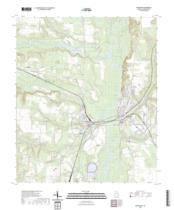
2024 Map of Montezuma
USGS Topo · Published 2024About this map
Oglethorpe and Montezuma face each other across the Flint River in this detailed survey of Macon County. The geography is defined by the river’s wide floodplain and numerous tributaries, including Buck Creek, Mill Creek, and Whitewater Creek, which flows into the expansive Whitewater Pond near the small settlement of Bartlett. The logistical heart of the area is centered at the Macon County Courthouse in Oglethorpe, where the CSX Transportation line cuts through the landscape. For genealogists and local historians, several important sites are documented, such as the Oglethorpe City Cem, Felton Cem, and Travelers Rest Cem. The map captures a mix of civic infrastructure, from the Dr C. P. Savage Sr. Airport to the wetland terrain of the Cutoff and Chase Lake, reflecting the intersection of industrial rail transport and the natural hydrology of the Georgia coastal plain.
Find a feature on this map
118 named features on this map. Tap any name to fly to it.
Don’t see what you’re looking for? This feature index may not catch every label — zoom into the map to look around manually.
Map Details
Editions of this 2024 Montezuma Map
This is the sole edition of this map. No revisions or reprints were ever made.
Other maps of this area

1955 · Phenix City
USGS Topo · 1:250,000

1957 · Phenix City
USGS Topo · 1:250,000

1957 · Macon
USGS Topo · 1:250,000

1958 · Macon
USGS Topo · 1:250,000

1958 · Phenix City
USGS Topo · 1:250,000

1964 · Macon
USGS Topo · 1:250,000

1971 · Ideal South
USGS Topo · 1:24,000

1971 · Ideal North
USGS Topo · 1:24,000

1971 · Garden Valley
USGS Topo · 1:24,000

1971 · Montezuma
USGS Topo · 1:24,000